 Catalogue GeoBretagne
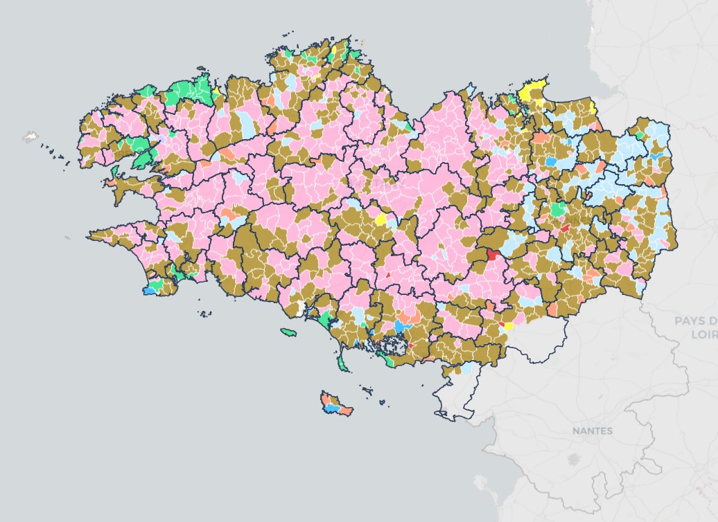
Recensement agricole 2020 par commune en Bretagne
Chiffres-clés pour chaque commune de Bretagne sur les données du recensement agricole 2020:
Nombre d’exploitations
Otex
SAU
UGB (totaux, herbivores, non herbivores)
PBS
ETP
Surfaces COP
Surfaces prairies
Surfaces cultures permanentes.
Simple
- Alternate title
-
RA2020
- Date (Publication)
- 2023-09-05
- Edition
-
2020
- Citation identifier
- https://kartenn.region-bretagne.fr/geonetwork/srv/fre/xml.metadata.get?uuid=3ed2a86c-8f30-483c-97c1-7816cc92c806
- Status
- Completed
- Point of contact
-
Organisation name Individual name Electronic mail address Role Région Bretagne
Service Aménagement, Foncier et Habitat
Point of contact DRAAF Bretagne
DRAAF Bretagne
Resource provider
- Maintenance and update frequency
- Not planned
- Maintenance note
-
Tous les 10 ans
- Theme
-
-
agreste
-
agriculture
-
otex
-
sau
-
ugb
-
données ouvertes
-
233500016
-
-
GEMET - INSPIRE themes, version 1.0
-
-
Installations agricoles et aquacoles
-
- Place
-
-
Bretagne
-
- Access constraints
- Other restrictions
- Other constraints
- Pas de restriction d'accès public
- Use limitation
-
Usage libre sous réserve des mentions obligatoires sur tout document de diffusion : "Source : DRAAF Bretagne"
- Use limitation
-
Licence ouverte : https://www.etalab.gouv.fr/licence-ouverte-open-licence
- Use constraints
- License
- Spatial representation type
- Vector
- Denominator
- 5000
- Language
-
fre
- Topic category
-
- Imagery base maps earth cover
))
- Reference system identifier
- RGF93 / Lambert-93 (EPSG:2154)
- Topology level
- Abstract
- Geometric object type
- Surface
- Distribution format
-
Name Version ESRI Shapefile
1.0
Digital transfer options
- OnLine resource
-
Protocol Linkage Name OGC:WMS
https://ows.region-bretagne.fr/geoserver/rb/wms?REQUEST=GetCapabilities&SERVICE=WMS agreste
OGC:WFS
https://ows.region-bretagne.fr/geoserver/rb/wfs?REQUEST=GetCapabilities&SERVICE=WFS agreste
WWW:LINK-1.0-http--link
https://kartenn.region-bretagne.fr/kartoviz/?config=apps/region/economie/agriculture.xml# Kartenn agriculture
- Hierarchy level
- Dataset
Conformance result
- Title
-
COMMISSION REGULATION (EU) No 1089/2010 of 23 November 2010 implementing Directive 2007/2/EC of the European Parliament and of the Council as regards interoperability of spatial data sets and services
- Date (Publication)
- 2010-10-23
- Explanation
-
Non Evalué
- Pass
- No
- Statement
-
Limite des communes : Admin express -
Données attributaire : https://draaf.bretagne.agriculture.gouv.fr/les-resultats-du-recensement-agricole-2020-r668.html
Metadata
- File identifier
- 3ed2a86c-8f30-483c-97c1-7816cc92c806 XML
- Metadata language
-
fre
- Character set
- UTF8
- Hierarchy level
- Dataset
- Date stamp
- 2025-05-26T15:54:30
- Metadata standard name
-
ISO 19115
- Metadata author
-
Organisation name Individual name Electronic mail address Role Région Bretagne
Service Aménagement, Foncier et Habitat
Point of contact
)))