Catalogue GeoBretagne
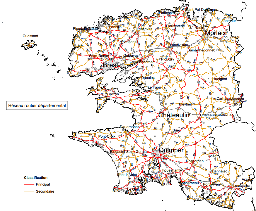
Réseau routier départemental du Finistère
Filaire de voirie du réseau routier départemental du Finistère. Classement réseau principal ou secondaire.
Simple
- Date (Revision)
- 2024-02-01T00:00:00
- Citation identifier
- https://geobretagne.fr/geonetwork/srv/fre/xml.metadata.get?uuid=b3f963b4-416d-4997-b3bf-9253d1aeb3eb
- Citation identifier
- FR-222900011-RTE03
- Status
- On going
- Point of contact
-
Organisation name Individual name Electronic mail address Role Département du Finistère
Direction des Routes et des Infrastructures de Déplacement (D.R.I.D.) / S.G.E.R.
Custodian
- Theme
-
-
Transport
-
Réseau routier
-
Route
-
données ouvertes
-
-
local._none_.geobretagne
-
-
Infrastructures de transport
-
-
GEMET - INSPIRE themes, version 1.0
-
-
Réseaux de transport
-
- Place
-
-
Finistère
-
- Use limitation
-
Usage libre sous réserve des mentions obligatoires sur tout document de diffusion : "Source : Conseil départemental du Finistère - 2024"
- Use limitation
-
Licence ouverte v2.0 : https://www.etalab.gouv.fr/wp-content/uploads/2017/04/ETALAB-Licence-Ouverte-v2.0.pdf
- Access constraints
- Other restrictions
- Use constraints
- License
- Other constraints
-
Pas de restriction d’accès public
- Denominator
- 5000
- Language
-
fre
- Topic category
-
- Transportation
))
- Reference system identifier
- RGF93 / Lambert-93 (EPSG:2154)
- Topology level
- Abstract
- Geometric object type
- Curve
- Geometric object count
- 2169
- Distribution format
-
Name Version ESRI Shapefile
1.0
- Distributor contact
-
Organisation name Individual name Electronic mail address Role Conseil départemental du Finistère
D.R.I.D / Service Gestion et Exploitation de la Route (S.G.E.R.)
Custodian
- OnLine resource
-
Protocol Linkage Name OGC:WFS
https://geobretagne.fr/geoserver/cd29/wfs?request=GetCapabilities reseau_routier_29
- OnLine resource
-
Protocol Linkage Name OGC:WMS
https://geobretagne.fr/geoserver/cd29/wms reseau_routier_29
- Hierarchy level
- Dataset
- Statement
-
L'origine de la géométrie est le filaire de voirie de la BD TOPO de l'IGN, modifié et complété le cas échéant par des levés terrains, la précision métrique du tracé est conservée.
La couche est mise à jour à partir de levés terrains pour l'intégration des nouveaux tronçons.
Metadata
- File identifier
- b3f963b4-416d-4997-b3bf-9253d1aeb3eb XML
- Metadata language
-
fre
- Character set
- UTF8
- Hierarchy level
- Dataset
- Hierarchy level name
-
# 11110
- Date stamp
- 2024-02-16T14:31:53Z
- Metadata standard name
-
ISO 19115:2003/19139
- Metadata standard version
-
1.0
- Metadata author
-
Organisation name Individual name Electronic mail address Role Département du Finistère
SIG Fédérateur
Custodian
Overviews
Spatial extent
Provided by