 Catalogue GeoBretagne
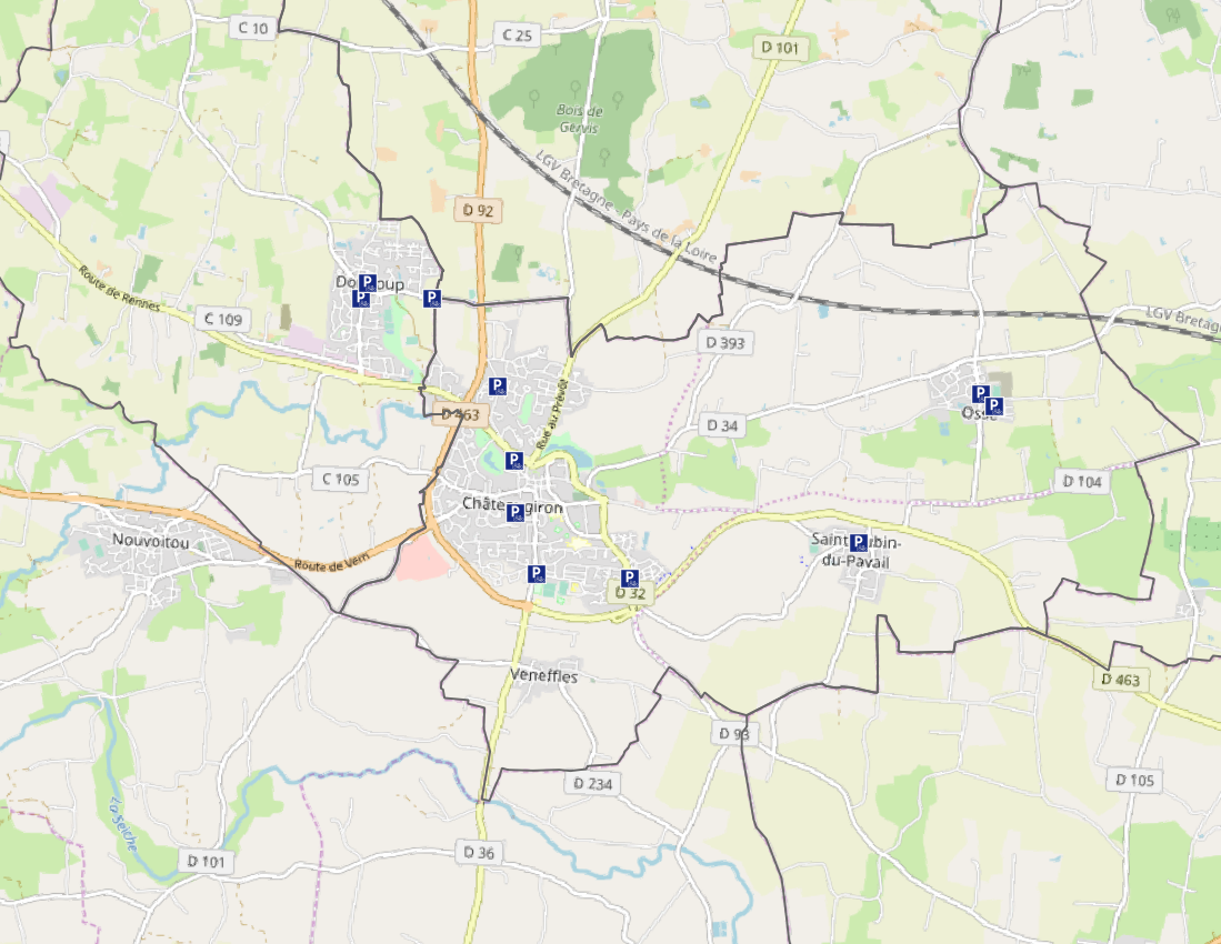
Les abris vélos disponibles sur le territoire du Pays de Châteaugiron Communauté
Les abris vélos disponibles sur le territoire du Pays de Châteaugiron Communauté mis à disposition des administrés
Simple
- Date (Creation)
- 2020-02-17
- Citation identifier
- https://geobretagne.fr/geonetwork/srv/fre/xml_iso19139?uuid=f1f8c538-0d04-4a17-b31e-7b0cabe67118
- Status
- Completed
- Point of contact
-
Organisation name Individual name Electronic mail address Role Pays de Châteaugiron Communauté
DGA Pôle Ressources - SIG
Author
- Maintenance and update frequency
- As needed
- Metadata author
-
Organisation name Individual name Electronic mail address Role Pays de Châteaugiron Communauté
DGA Pôle Ressources - SIG
Author
-
GéoBretagne v 2.0
-
-
mobilité transport : stationnement
-
-
INSPIRE themes
-
-
Réseaux de transport
-
-
GEMET
-
-
bicyclette
-
données géoréférencées
-
- Theme
-
-
données ouvertes
-
- Use limitation
-
Usage libre sous réserve des mentions obligatoires sur tout document de diffusion : "Source : Pays de Châteaugiron Communauté"
- Use limitation
-
Licence ouverte v2.0 : https://www.etalab.gouv.fr/wp-content/uploads/2017/04/ETALAB-Licence-Ouverte-v2.0.pdf
- Access constraints
- Other restrictions
- Use constraints
- License
- Other constraints
-
Pas de restriction d’accès public
- Spatial representation type
- Vector
- Denominator
- 1000
- Language
-
fre
- Topic category
-
- Location
))
- Reference system identifier
- RGF93 / Lambert-93 (EPSG:2154)
- Topology level
- Geometry only
- Geometric object type
- Surface
- Distribution format
-
Name Version ESRI Shapefile
1.0
Digital transfer options
- OnLine resource
-
Protocol Linkage Name WWW:DOWNLOAD-1.0-http--download
https://geobretagne.fr/geoserver/payschateaugiron/wfs?SERVICE=WFS&VERSION=2.0.0&REQUEST=GetFeature&typeName=PCC_ABRIS_VELO&OUTPUTFORMAT=SHAPE-ZIP OGC:WMS
https://geobretagne.fr/geoserver/payschateaugiron/wms PCC_ABRIS_VELO
OGC:WFS
https://geobretagne.fr/geoserver/payschateaugiron/wfs PCC_ABRIS_VELO
- Hierarchy level
- Dataset
Conformance result
- Title
-
COMMISSION REGULATION (EU) No 1089/2010 of 23 November 2010 implementing Directive 2007/2/EC of the European Parliament and of the Council as regards interoperability of spatial data sets and services
- Date (Creation)
- 2020-01-23
- Explanation
-
Non Evalué
- Pass
- No
- Statement
-
Fond de plan utilisé pour la numérisation : PCI vecteur
Metadata
- File identifier
- f1f8c538-0d04-4a17-b31e-7b0cabe67118 XML
- Metadata language
-
fre
- Character set
- UTF8
- Hierarchy level
- Dataset
- Date stamp
- 2020-02-17T14:47:06
- Metadata standard name
-
ISO 19115
- Metadata author
-
Organisation name Individual name Electronic mail address Role Pays de Châteaugiron Communauté
DGA Pôle Ressources - SIG
Point of contact
)))